
Introduction
Long before the construction of modern highways, the Inca civilization developed one of the greatest engineering achievements in history: the Qhapaq Ñan, also known as the Great Inca Road.
This extraordinary road network connected vast territories across mountains, valleys, deserts, and tropical forests, enabling the political, economic, and cultural integration of the Inca Empire. Stretching for more than 30,000 kilometers (18,600 miles), the Qhapaq Ñan became the largest road system in pre-Columbian America and one of the most advanced transportation networks of the ancient world.
Today, its trails remain a remarkable testament to the ingenuity, organization, and vision of a civilization that united much of South America without the use of wheels, horses, or iron tools.
What Does Qhapaq Ñan Mean?
The term Qhapaq Ñan comes from the Quechua language:
- Qhapaq means “great,” “principal,” “royal,” or “important.”
- Ñan means “road” or “path.”
Therefore, Qhapaq Ñan can be translated as:
- The Great Road
- The Main Road
- The Royal Road of the Incas
However, the name does not refer to a single road but to an extensive network of interconnected routes that linked every region of the Inca Empire.
The Origins of the Qhapaq Ñan
Although some of its routes existed before the rise of the Inca Empire, the road system reached its greatest development during the reign of the Inca emperors—especially under Pachacuti in the 15th century.
As the empire expanded, it became essential to connect cities, administrative centers, fortresses, temples, and agricultural regions.
The solution was an ambitious transportation network capable of crossing some of the most challenging landscapes on the continent.
The Largest Road Network in Pre-Columbian America
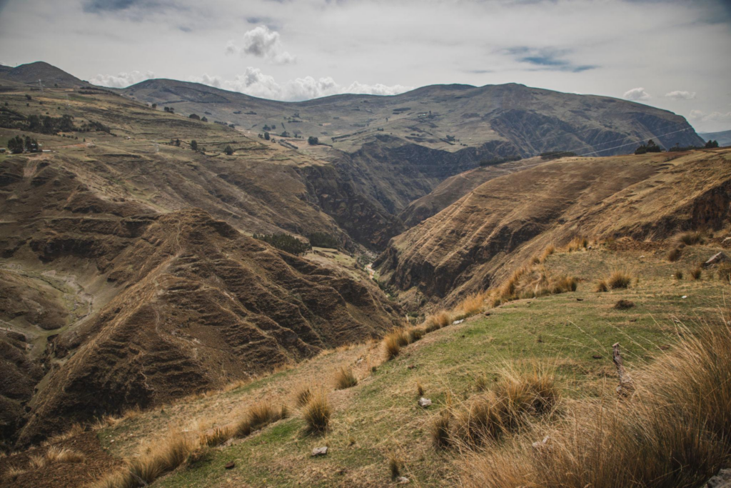
At its greatest extent, the Qhapaq Ñan stretched for approximately 30,000 kilometers (18,600 miles).
The network crossed territories that are now part of:
- Peru
- Ecuador
- Bolivia
- Chile
- Argentina
- Colombia
This remarkable infrastructure united millions of people under a single imperial administration.
How Was the Qhapaq Ñan Organized?
The road network consisted of two primary routes.
The Highland Route
This route followed the Andes Mountains from north to south.
It was the empire’s principal highway, connecting strategic cities, ceremonial centers, and agricultural regions.
The Coastal Route
Running along Peru’s Pacific coastline, this route connected coastal settlements with the imperial capital and inland regions.
The two major highways were linked by numerous cross routes, allowing efficient access to every corner of the empire.
An Engineering Masterpiece
One of the most impressive aspects of the Qhapaq Ñan is that it was built across extremely difficult terrain.
The Incas successfully constructed roads through:
- Mountains exceeding 5,000 meters (16,400 feet) in elevation
- Deep canyons
- Tropical cloud forests
- Arid deserts
- Powerful rivers
To overcome these challenges, they engineered:
- Stone stairways
- Retaining walls
- Advanced drainage systems
- Tunnels
- Suspension bridges woven from natural plant fibers
Many of these structures continue to function more than 500 years after they were built.
The Chasquis: Messengers of the Inca Empire

A key element of the Qhapaq Ñan was the Chasquis, highly trained runners responsible for delivering messages and goods across the empire.
The Chasquis worked using a relay system.
When one messenger completed his assigned section, another immediately continued the journey.
This remarkably efficient system allowed information to travel hundreds of kilometers in an incredibly short time for the era.
Tambos: Rest Stops and Supply Centers
Along the road network were structures known as Tambos.
These facilities served as:
- Rest stations
- Food storage facilities
- Shelters for travelers
- Administrative centers
Tambos played a crucial role in maintaining the efficiency of transportation, communication, and government operations throughout the empire.
Why Was the Qhapaq Ñan So Important?
The road system fulfilled several essential functions.
Government Administration
It enabled Inca rulers to supervise and govern distant provinces efficiently.
Trade
The roads facilitated the transportation of agricultural products, textiles, ceramics, and valuable mineral resources.
Communication
The Qhapaq Ñan allowed rapid communication between different regions of the empire.
Military Defense
Troops could quickly move across vast distances whenever conflicts or threats arose.
Cultural Integration
The network helped spread languages, traditions, religious beliefs, and customs throughout the Inca world.
The Inca Trail to Machu Picchu: Part of the Qhapaq Ñan
One of the most famous sections of the Qhapaq Ñan is today’s Classic Inca Trail to Machu Picchu.
This historic route connected important ceremonial centers and provided access to the sacred citadel of Machu Picchu.
Along the trail, hikers encounter remarkable archaeological sites, including:
- Wiñay Wayna
- Phuyupatamarca
- Sayacmarca
- Runkurakay
Today, this section is recognized as one of the world’s most iconic trekking routes.
The Qhapaq Ñan After the Spanish Conquest
Following the arrival of the Spanish conquistadors in the 16th century, much of the road system gradually fell out of use.
Some routes were abandoned, while others became incorporated into colonial transportation networks.
Despite these changes, many sections survived and continue to be used by Andean communities to this day.
UNESCO World Heritage Site
In 2014, the Qhapaq Ñan was inscribed on the UNESCO World Heritage List.
The designation recognized its outstanding historical, cultural, archaeological, and engineering significance, as well as its continuing importance to the indigenous communities that preserve traditions connected to these ancient roads.
The nomination was jointly presented by six South American countries that share this extraordinary heritage.
Fascinating Facts About the Qhapaq Ñan
- It is the largest road network ever built in pre-Columbian America.
- It stretched for more than 30,000 kilometers (18,600 miles).
- It connected territories across six modern South American countries.
- It was constructed without wheels or large draft animals.
- Many sections are still used by Andean communities today.
- Some of its drainage systems continue to function after more than five centuries.
- The Chasquis transmitted information with astonishing speed for their time.
- It includes some of the world’s most famous archaeological hiking trails.
Frequently Asked Questions About the Qhapaq Ñan
What does Qhapaq Ñan mean?
It means “Great Road,” “Main Road,” or “Royal Road” in the Quechua language.
How long was the Qhapaq Ñan?
The network extended for more than 30,000 kilometers (18,600 miles).
Who built the Qhapaq Ñan?
The road network was developed by the Inca civilization, although it incorporated and expanded routes previously used by earlier Andean cultures.
What was its primary purpose?
Its main purpose was to connect and administer the territories of the Inca Empire while facilitating communication, trade, and military movement.
Does the Qhapaq Ñan still exist?
Yes. Many sections remain remarkably well preserved and continue to be used by local Andean communities.
Is the Inca Trail part of the Qhapaq Ñan?
Yes. The famous Inca Trail to Machu Picchu is one of the best-preserved and most visited sections of the vast Qhapaq Ñan network.
Conclusion
The Qhapaq Ñan stands as one of the greatest achievements in engineering and organization in the history of the Americas. More than just a system of roads, it was the foundation that united a vast empire across some of the most challenging landscapes on Earth.
Today, its ancient trails continue to tell the story of an extraordinary civilization that transformed the Andes and left behind a legacy that still inspires the world. To explore the Qhapaq Ñan is to understand how the Incas connected cultures, territories, and people through an engineering masterpiece that remains alive more than five centuries later.